A new article has been published with MyCOAST funding: El Serafy G, Mészáros L, Fernández V, Capet A, She J, Sotillo MG, Melet A, Legrand S, Mourre B, Campuzano F, Federico I, Guarnieri A, Rubio A, Dabrowski T, Umgiesser G, Staneva J, Ursella L, Pairaud I, Bruschi A, Frigstad H, Baetens K, Creach V, Charria G and Alvarez Fanjul E. EuroGOOS roadmap for operational coastal downstream services. Frontiers of Marine Science. 2023; 10:1177615. doi: 10.3389/fmars.2023.1177615.
The second Progress Meeting of the MyCOAST extension will take place on 29-30 November 2022 in Santiago de Compostela, followed by the IBIROOS 2022 Annual meeting, 30 November – 1 December.
A new article has been published with MyCOAST funding for one of the co-authors (Francisco Campuzano): Franz G, Garcia CAE, Pereira J, de Freitas Assad LP, Rollnic M, Garbossa LHP, da Cunha LC, Lentini CAD, Nobre P, Turra A, Trotte-Duhá JR, Cirano M, Estefen SF, Lima JAM, Paiva AM, Noernberg MA, Tanajura CAS, Moutinho JL, Campuzano F, Pereira ES, Lima AC, Mendonça LFF, Nocko H, Machado L, Alvarenga JBR, Martins RP, Böck CS, Toste R, Landau L, Miranda T, dos Santos F, Pellegrini J, Juliano M, Neves R and Polejack A (2021) Coastal Ocean Observing and Modeling Systems in Brazil: Initiatives and Future Perspectives. Front. Mar. Sci. 8:681619. doi: 10.3389/fmars.2021.681619
Read MoreA coastal observatory is a system for integrating and disseminating meteo-oceanographic information from the perspective of providing services to entities that carry out economic activity, leisure, or scientific research in the coastal regions. As part of the MyCOASTproject, a coastal observatory for the Metropolitan Area of Lisbon (MELISA) is being developed. The geographical scope of the observatory includes the areas of influence of the Tagus and Sado estuaries and promotes an integrated approach to water management from inland waters to the ocean, including transitional waters. In order to obtain better governance and better knowledge of the coastal area covered, the observatory will aggregate and disseminate observations, forecasts and alerts produced by different institutions that are dedicated to the study and monitoring of this area, thus fostering an integrative, multidisciplinary and collaborative approach. See the Downloads section for a more comprehensive description of MELISA.
The was a presentation of the MyCOAST project as one of the highlights of IBIROOS activity (regional cooperation for observing systems and marine services) at the EuroGOOS Annual Assembly 2021
A new article has been published by MyCOAST partners: Sotillo MG, Campuzano F, Guihou K, Lorente P, Olmedo E, Matulka A, Santos F, Amo-Baladrón MA, Novellino A. River Freshwater Contribution in Operational Ocean Models along the European Atlantic Façade: Impact of a New River Discharge Forcing Data on the CMEMS IBI Regional Model Solution. Journal of Marine Science and Engineering. 2021; 9(4):401. The MyCOAST partnership has contributed to this work as part of our multi-model intercomparison activities.
Read MoreOn 14th May 1886, Augusto González de Linares founded the Santander Biological station. On 14th May 2020, 134 years later, its very easy access to deep waters still makes Santander a privileged site for ocean research. Since 1991, MyCOAST project partner IEO have been sampling a hydrographical transect off Santander to a depth of 2000 m. At each monthly sampling, hydrographic and biogeochemical parameters, such as temperature, salinity, chlorophyll and oxygen are measured by a CTD and water samples are taken for calibration. An oceanographic buoy, the Augusto Gonzalez de Linares buoy (http://www.ieo.es/en/boya-agl) was moored in 2007 by the IEO at 2800 m depth in the Southern Bay of Biscay (43.8 ◦ N, 3.8 ◦ W) and, since then, it provides hourly data of the main atmospheric, oceanographic, and biogeochemical parameters as air pressure and temperature; relative humidity, wind direction, and speed (at a 2 m height); sea surface temperature (SST) and salinity (SSS); and dissolved oxygen and chlorophyll (at 3 m depth). The hydrographic station associated with the AGL buoy has been sampled since 1994 and is called SATS (Santander Atlantic Time Series). SATS data provides high-frequency repeated observations of interlinked meteorological, oceanographic, and biogeochemical variables that provide a comprehensive description of ocean processes from the seafloor to the atmosphere at a site that is representative of the mid-latitudes of the Eastern North Atlantic.
For the first time, SATS data are available at OceanSITES Global Data Assembly Center GDAC (http://www.oceansites.org/data/). You can find the data at http://tds0.ifremer.fr/thredds/catalog/CORIOLIS-OCEANSITES-GDAC-OBS/DATA/catalog.html. We want to thank colleagues @Oceansites, who helped in the process, and MyCOAST for supporting SATS. The effort to get SATS data in the Oceansites format to be disseminated in the OceanSITES GDAC is part of the developments of MyCOAST WP6 on developing and adopting common standards for model and observational data supporting coastal services. Further information is available from Raquel Somavilla @SomavillaRaquel, IEO Santander.
The publication "Operational Modeling Capacity in European Seas—An EuroGOOS Perspective and Recommendations for Improvement" by Capet A, Fernández V, She J, Dabrowski T, Umgiesser G, Staneva J, Mészáros L, Campuzano F, Ursella L, Nolan G and El Serafy G has been published in Front. Mar. Sci. 7:129. doi: 10.3389/fmars.2020.00129 with MyCOAST contribution.
Read MoreThe MyCOAST project has been identified as a Use Case by the Copernicus Marine Service. It is a relevant example of how CMEMS data is used by intermediate users for coastal monitoring, marine policy, science and climate. Find a downloadable description under Downloads
Read MoreThe 2nd MyCOAST Regional Workshop "Tools for tackling coastal risks in coastal observatories" will take place in Santiago de Compostela on 26 March 2020. Find the workshop programme and details about the location on the Downloads page.
MyCOAST partners Meteogalicia and Inctemar contributed a presentation (with proceedings) at ICCS2019, “An Integrated Perspective of the Operational Forecasting System in Rías Baixas (Galicia, Spain) with Observational Data and End-Users” (Venancio et al., (2019) https://link.springer.com/chapter/10.1007%2F978-3-030-22747-0_18).
MyCOAST partner Plymouth Marine Laboratory presented the operational Tamar model of MyCOAST in the Tamar Catchment Partnership meeting (2 December) and published a chapter (Uncles, R.J., Clark, J.R., Bedington, M., Torres, R., 2020. Chapter 31 - On sediment dispersal in the Whitsand Bay Marine Conservation Zone: Neighbour to a closed dredge-spoil disposal site, in: Humphreys, J., Clark, R.W.E. (Eds.), Marine Protected Areas. Elsevier, pp. 599–629. https://doi.org/10.1016/B978-0-08-102698-4.00031-9) with acknowledgement of MyCOAST contributions
MyCOAST partner Plymouth Marine Laboratory deployed in December an ADCP at the L4 coastal monitoring station. The ADCP will be in the water recording currents and waves until mid-February.
As part of MyCOAST, the UNDERSEE_water instrument (see http://periscope-network.eu/spotlight/undersee-multi-sensor-fusion-system-water-quality-monitoring-0) was installed on a ferry boat from TransTejo connecting Lisbon with Cacilhas to collect water quality of the Tagus Estuary. The ferrybox system is currently being tested.
A national workshop on turbidity measurement was organised on 26-27 November 2019 in Brest with support from MyCOAST. The aim of the workshop was to harmonize turbidity measurement in French observing networks (COAST-HF network, river observing networks: Seine, Loire, Gironde, Shom turbidity monitoring).
Partner IFREMER and colleagues presented a poster of the High Frequency Radar network at OceanObs 19 (16-20 Sep 2019) with introduction of links with MyCOAST: “National observation infrastructures in a European framework: COAST-HF: A fixed-platform network along French coasts”.
Two oral presentations supported by MyCOAST were delivered at the Ocean Predict'19 GODAE OceanView Symposium, 6-10 May 2019, in Halifax, Canada (see slides at Dowloads): (1) "National observation infrastructures in a European framework: COAST-HF – An example of a fixed-platform network along French coasts" by Guillaume Charria and François Schmitt; and (2) " Multi-scale coastal circulation in the Bay of Biscay" by Guillaume Charria, Sébastien Theetten, Adam Ayouche, Anil Akpinar and Frédéric Vandermeirsch
A MyCOAST poster was presented at the CMEMS General Assembly meeting in May 2019 (see Dowloads)
The MyCOAST project was represented at two events at the European Maritime Day in Lisbon: The pitch session, where the Lisbon Observatory which we are planning to develop during the project was presented; and the side event at the Padrão dos Descobrimentos, where a project decription slide show with voiceover was run on a loop. Check out the Downloads section for a copy of the slide show.
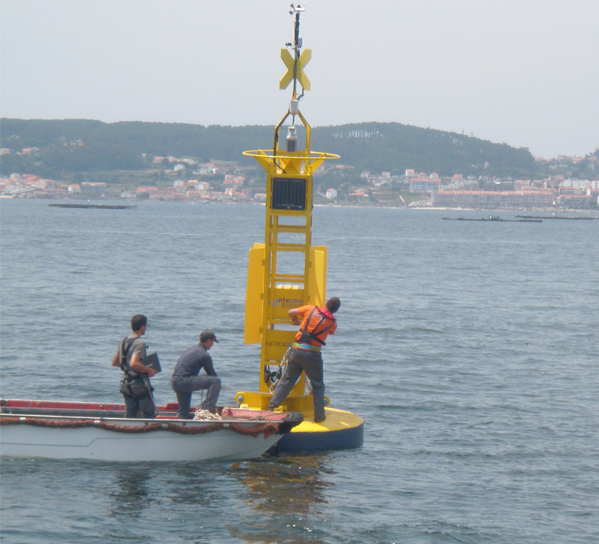
A video from an antipollution drill, by MyCOAST partner INTECMAR
Watch VideoTwo MyCOAST posters were presented at the International Conference on Marine Data and Information Systems (IMDIS) in Barcelona (5-7 November). Hindson et al. presented a poster on "The Scottish Coastal Observatory" and Montero et al. on "Complying with Data Interoperability Standards in MyCOAST Project"
Read MoreMyCOAST were invited to present at the INTERREG Atlantic Area Annual Event in a session on projects with a high innovative component, followed by a round table were we had "the opportunity to share their experience and good practices to contribute to the improvement of the maritime economy in the Atlantic regions through transnational cooperation".
Our message was that MyCOAST is based in transnational cooperation, standardisation, co-development and stakeholder involvement. The MyCOAST presentation was a success.
Read MoreAs part of MyCOAST WP 8 (Action 5), some HNS and oil spill training exercises will be carried out by various project partners, with the ideal objective of trans-boundary drills. However, in the first instance, an exercise in which the Galician Coastguard had to recover some HNS drums took place on 18 July 2018. Various tools such as drifters and numerical models were used within a Common Operating Picture (COP). This was Exercise number 0 (state-of-the-art) of WP8 Action 5.
Read More Watch VideoMarine Scotland Science presented a poster at the 2018 conference of the UK National Partnership for Ocean Prediction (NPOP) entitled "Marine Scotland Science's Oceanographic Observing & Modelling Framework", which included a description of the model operationalisation developments that will take place in MyCOAST
Read More